Cognocoli-Monticchi on the relief France map in Lambert 93 coordinates
|

See the map of Cognocoli-Monticchi in full screen (1000 x 949)
|
At left, here is the location of Cognocoli-Monticchi on the relief France map in Lambert 93 coordinates.
Here are the altitudes of Cognocoli-Monticchi :
- Town hall altitude of Cognocoli-Monticchi is 400 meters
- Minimum altitude of Cognocoli-Monticchi is 9 meters
- Maximum altitude of Cognocoli-Monticchi is 857 meters
- Medium altitude of Cognocoli-Monticchi is 433 meters
Here are the altitudes of Ajaccio, prefecture of Corse-du-Sud department:
- Town hall altitude of Ajaccio is 20 meters
- Minimum altitude of Ajaccio is 0 meters
- Maximum altitude of Ajaccio is 787 meters
- Medium altitude of Ajaccio is 394 meters
Here are the altitudes of the french biggest cities:
Paris : 33 meters
Marseille : 20 meters
Lyon : 237 meters
Toulouse : 146 meters
Nice : 10 meters
Nantes : 20 meters
Strasbourg : 144 meters
Montpellier : 35 meters
Bordeaux : 16 meters
Lille : 20 meters
Rennes : 35 meters
Reims : 83 meters
Click here for the terrain map of Cognocoli-Monticchi in full screen:
Relief map of Cognocoli-Monticchi
|
This relief map of Cognocoli-Monticchi is reusable and modifiable by making a link to this page of the Map-France.com website or by using the given code :
|
Terrain base map of Cognocoli-Monticchi
|

See the terrain base map of Cognocoli-Monticchi in full screen (1000 x 949)
|
Small relief base map of Cognocoli-Monticchi

|
This base map of Cognocoli-Monticchi is reusable and modifiable by making a link to this page of the Map-France.com website or by using the given code :
|
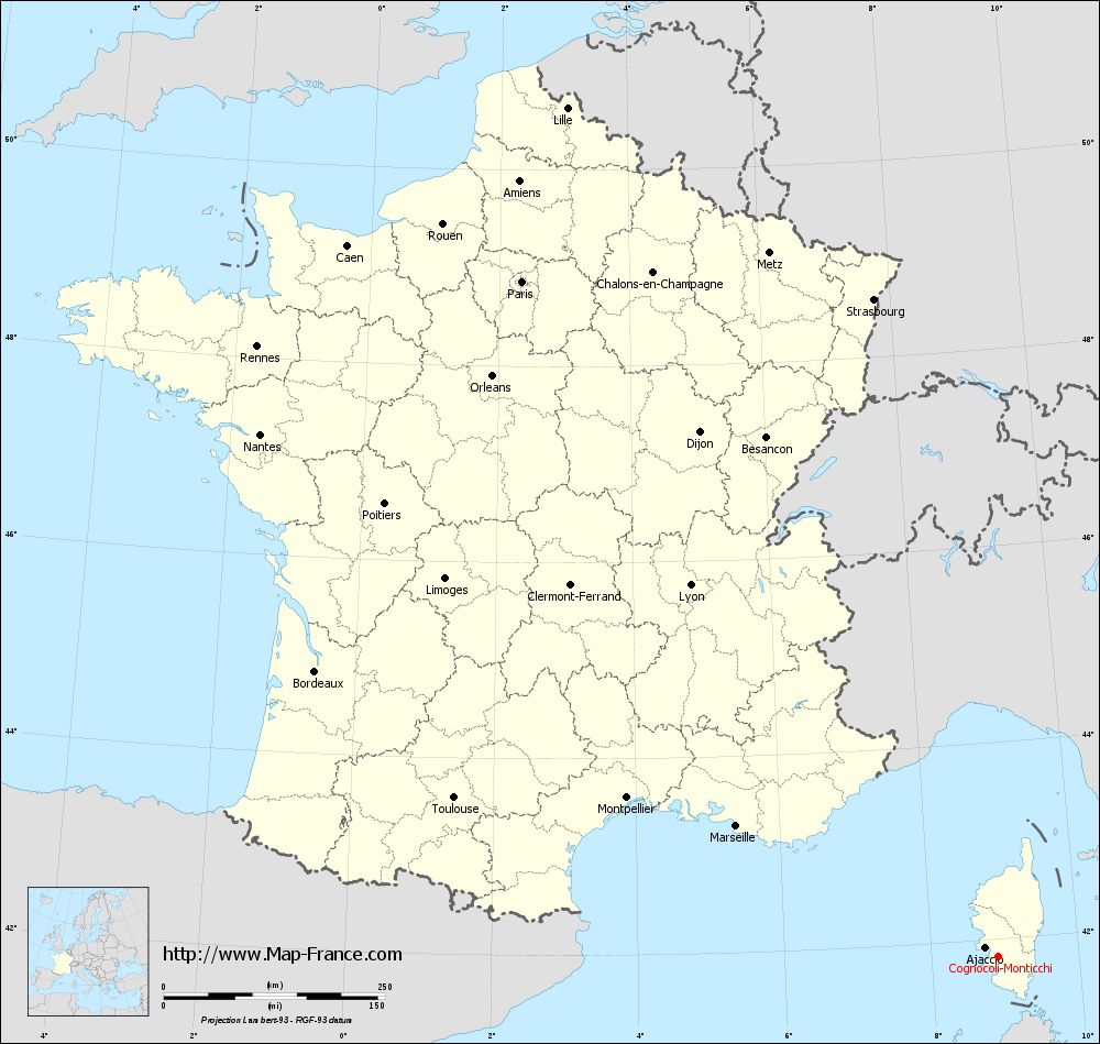
Map of Cognocoli-Monticchi with regions and prefectures
|
View the map of Cognocoli-Monticchi in full screen (1000 x 949)
|
You will find the location of Cognocoli-Monticchi on the map of France of regions in Lambert 93 coordinates. The town of Cognocoli-Monticchi is located in the department of Corse-du-Sud of the french region Corse.
Geographical sexagesimal coordinates / GPS (WGS84):
Latitude: 41° 49' 42'' North
Longitude: 08° 54' 21'' East
Geographical decimal coordinates :
Latitude: 41.829 degrees (41.829° North)
Longitude: 8.904 degrees (8.904° East)
Lambert 93 coordinates :
X: 11 913 hectometers
Y: 60 992 hectometers
Lambert 2 coordinates :
X: 11 470 hectometers
Y: 16 698 hectometers
Below, the geographical coordinates of Ajaccio, prefecture of the Corse-du-Sud department:
Geographical sexagesimal coordinates / GPS (WGS84):
Latitude: 41° 55' 32'' North
Longitude: 08° 44' 11'' East
Geographical decimal coordinates :
Latitude: 41.921 degrees (41.921° North)
Longitude: 8.735 degrees (8.735° East)
Lambert 93 coordinates :
X: 11 764 hectometers
Y: 61 090 hectometers
Lambert 2 coordinates :
X: 11 321 hectometers
Y: 16 795 hectometers
|
This map of Cognocoli-Monticchi is reusable and modifiable by making a link to this page of the Map-France.com website or by using the given code :
|
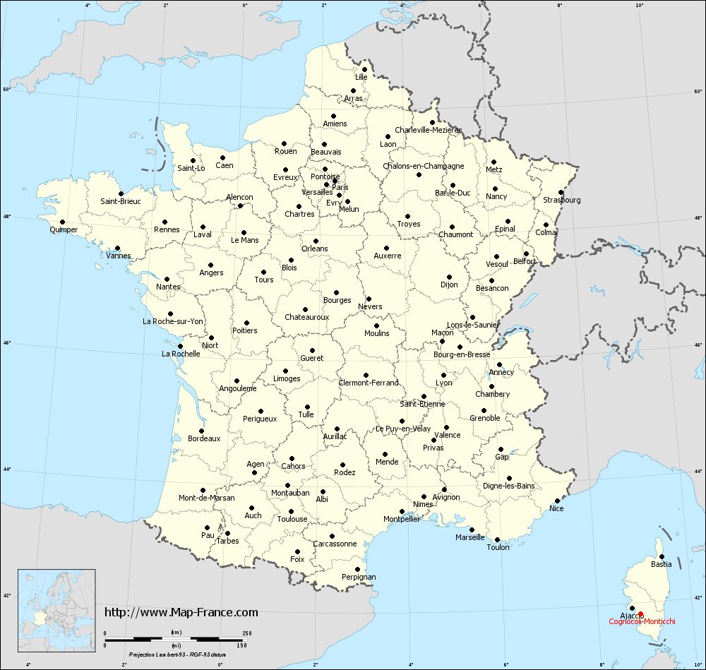
Map of Cognocoli-Monticchi with departments and prefectures
|
Voir la carte of Cognocoli-Monticchi en grand format (1000 x 949)
|
Here is the localization of Cognocoli-Monticchi on the France map of departments in Lambert 93 coordinates. The city of Cognocoli-Monticchi is shown on the map by a red point.
The town of Cognocoli-Monticchi is located in the department of Corse-du-Sud of the french region Corse.
The latitude of Cognocoli-Monticchi is 41.829 degrees North.
The longitude of Cognocoli-Monticchi is 8.904 degrees East.
Here the distance between Cognocoli-Monticchi and the biggest cities of France:
Distances are calculated as the crow flies (orthodromic distance)
Distance between Cognocoli-Monticchi and Paris : 933.37 kilometers
Distance between Cognocoli-Monticchi and Marseille : 329.91 kilometers
Distance between Cognocoli-Monticchi and Lyon : 545.03 kilometers
Distance between Cognocoli-Monticchi and Toulouse : 639.25 kilometers
Distance between Cognocoli-Monticchi and Nice : 247.83 kilometers
Distance between Cognocoli-Monticchi and Nantes : 1020.79 kilometers
Distance between Cognocoli-Monticchi and Strasbourg : 755.9 kilometers
Distance between Cognocoli-Monticchi and Montpellier : 455.62 kilometers
Distance between Cognocoli-Monticchi and Bordeaux : 835.35 kilometers
Distance between Cognocoli-Monticchi and Lille : 1075.53 kilometers
Distance between Cognocoli-Monticchi and Rennes : 1084.04 kilometers
Distance between Cognocoli-Monticchi and Reims : 907.85 kilometers
Clic here to see the map of Cognocoli-Monticchi in full screen:
Cognocoli-Monticchi on the map of french departments
|
This administrative map of Cognocoli-Monticchi is reusable and modifiable by making a link to this page of the Map-France.com website or by using the given code :
|
Administrative base maps of Cognocoli-Monticchi
|

See the administrative base map of Cognocoli-Monticchi in full screen (1000 x 949)
|
Small administrative base map of Cognocoli-Monticchi
|
This base map administrative of Cognocoli-Monticchi is reusable and modifiable by making a link to this page of the Map-France.com website or by using the given code :
|
 French Version : http://www.cartesfrance.fr