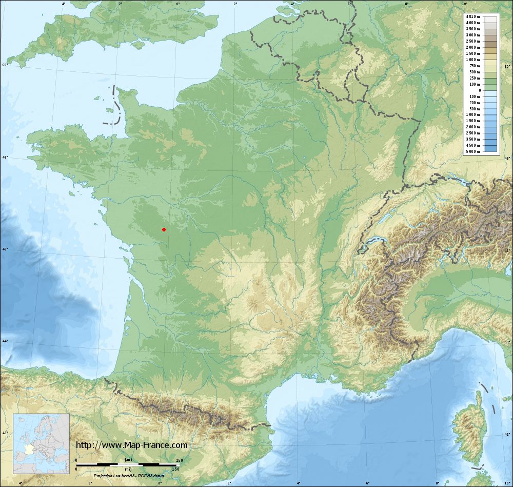
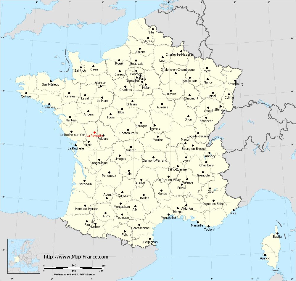
Map of La Peyratte with regions and prefectures
|
View the map of La Peyratte in full screen (1000 x 949)
|
You will find the location of La Peyratte on the map of France of regions in Lambert 93 coordinates. The town of La Peyratte is located in the department of Deux-Sèvres of the french region Poitou-Charentes.
Geographical sexagesimal coordinates / GPS (WGS84):
Latitude: 46° 40' 31'' North
Longitude: 00° 08' 52'' West
Geographical decimal coordinates :
Latitude: 46.676 degrees (46.676° North)
Longitude: -0.148 degrees (0.148° West)
Lambert 93 coordinates :
X: 4 594 hectometers
Y: 66 243 hectometers
Lambert 2 coordinates :
X: 4 100 hectometers
Y: 21 892 hectometers
Below, the geographical coordinates of Niort, prefecture of the Deux-Sèvres department:
Geographical sexagesimal coordinates / GPS (WGS84):
Latitude: 46° 19' 30'' North
Longitude: 00° 27' 44'' West
Geographical decimal coordinates :
Latitude: 46.324 degrees (46.324° North)
Longitude: -0.462 degrees (0.462° West)
Lambert 93 coordinates :
X: 4 337 hectometers
Y: 65 864 hectometers
Lambert 2 coordinates :
X: 3 845 hectometers
Y: 21 510 hectometers
|
This map of La Peyratte is reusable and modifiable by making a link to this page of the Map-France.com website or by using the given code :
|
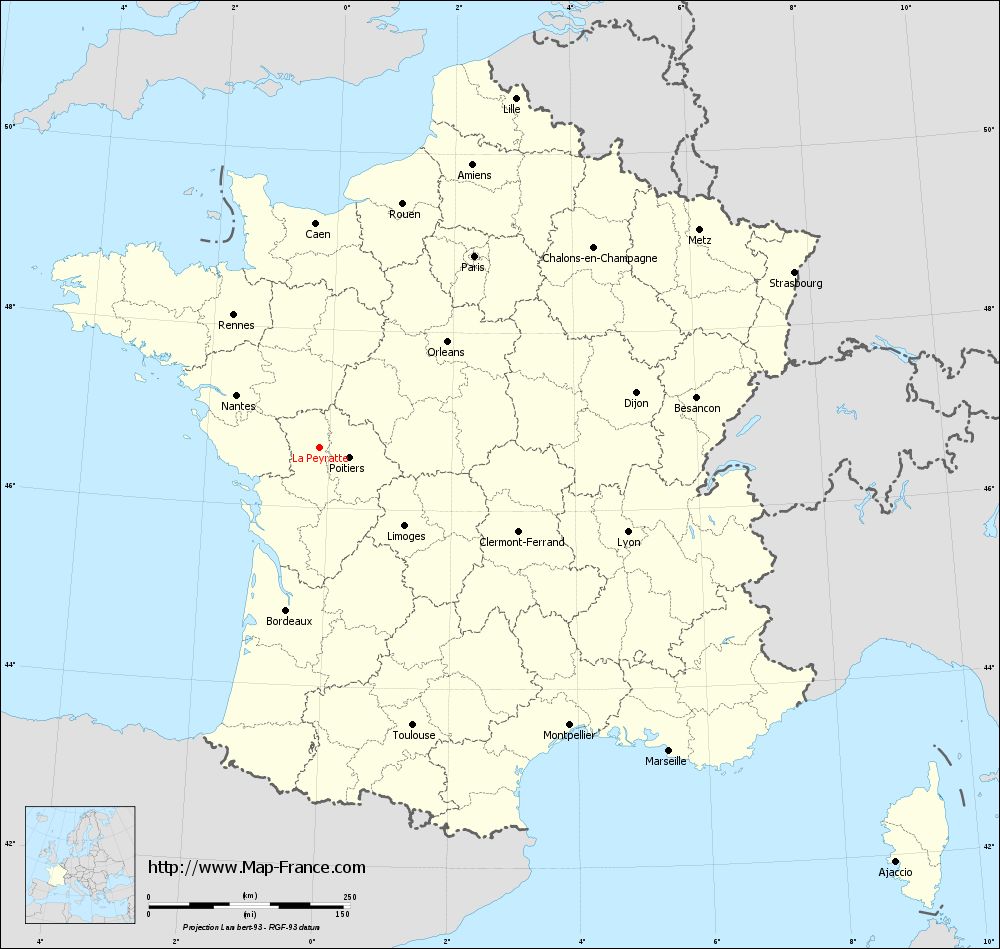
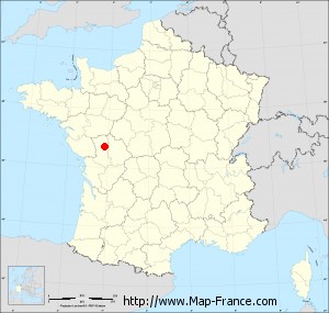
Map of La Peyratte with departments and prefectures
|
Voir la carte of La Peyratte en grand format (1000 x 949)
|
Here is the localization of La Peyratte on the France map of departments in Lambert 93 coordinates. The city of La Peyratte is shown on the map by a red point.
The town of La Peyratte is located in the department of Deux-Sèvres of the french region Poitou-Charentes.
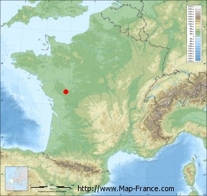
The latitude of La Peyratte is 46.676 degrees North.
The longitude of La Peyratte is 0.148 degrees West.
Here the distance between La Peyratte and the biggest cities of France:
Distances are calculated as the crow flies (orthodromic distance)
Distance between La Peyratte and Paris : 305.95 kilometers
Distance between La Peyratte and Marseille : 575.03 kilometers
Distance between La Peyratte and Lyon : 396.3 kilometers
Distance between La Peyratte and Toulouse : 363.97 kilometers
Distance between La Peyratte and Nice : 667.11 kilometers
Distance between La Peyratte and Nantes : 122.51 kilometers
Distance between La Peyratte and Strasbourg : 628.32 kilometers
Distance between La Peyratte and Montpellier : 464.08 kilometers
Distance between La Peyratte and Bordeaux : 206.3 kilometers
Distance between La Peyratte and Lille : 497.63 kilometers
Distance between La Peyratte and Rennes : 196.43 kilometers
Distance between La Peyratte and Reims : 422.96 kilometers
Clic here to see the map of La Peyratte in full screen:
La Peyratte on the map of french departments
|
This administrative map of La Peyratte is reusable and modifiable by making a link to this page of the Map-France.com website or by using the given code :
|
Administrative base maps of La Peyratte
|

See the administrative base map of La Peyratte in full screen (1000 x 949)
|
Small administrative base map of La Peyratte
|
This base map administrative of La Peyratte is reusable and modifiable by making a link to this page of the Map-France.com website or by using the given code :
|
 French Version : http://www.cartesfrance.fr