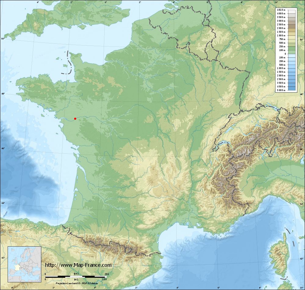
Mauves-sur-Loire on the relief France map in Lambert 93 coordinates
|

See the map of Mauves-sur-Loire in full screen (1000 x 949)
|
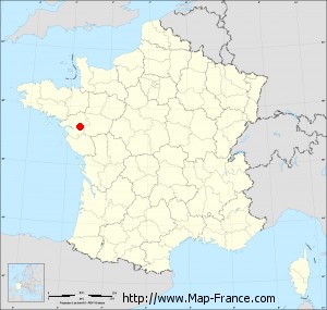
At left, here is the location of Mauves-sur-Loire on the relief France map in Lambert 93 coordinates.
Here are the altitudes of Mauves-sur-Loire :
- Town hall altitude of Mauves-sur-Loire is 40 meters
- Minimum altitude of Mauves-sur-Loire is 1 meters
- Maximum altitude of Mauves-sur-Loire is 84 meters
- Medium altitude of Mauves-sur-Loire is 43 meters
Here are the altitudes of Nantes, prefecture of Loire-Atlantique department:
- Town hall altitude of Nantes is 20 meters
- Minimum altitude of Nantes is 2 meters
- Maximum altitude of Nantes is 52 meters
- Medium altitude of Nantes is 27 meters
Here are the altitudes of the french biggest cities:
Paris : 33 meters
Marseille : 20 meters
Lyon : 237 meters
Toulouse : 146 meters
Nice : 10 meters
Nantes : 20 meters
Strasbourg : 144 meters
Montpellier : 35 meters
Bordeaux : 16 meters
Lille : 20 meters
Rennes : 35 meters
Reims : 83 meters
Click here for the terrain map of Mauves-sur-Loire in full screen:
Relief map of Mauves-sur-Loire
|
This relief map of Mauves-sur-Loire is reusable and modifiable by making a link to this page of the Map-France.com website or by using the given code :
|
Terrain base map of Mauves-sur-Loire
|
See the terrain base map of Mauves-sur-Loire in full screen (1000 x 949)
|
Small relief base map of Mauves-sur-Loire
|
This base map of Mauves-sur-Loire is reusable and modifiable by making a link to this page of the Map-France.com website or by using the given code :
|
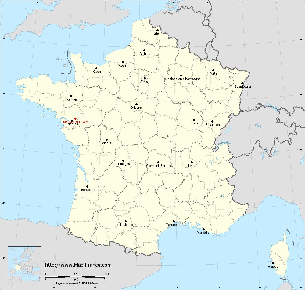
Map of Mauves-sur-Loire with regions and prefectures
|
View the map of Mauves-sur-Loire in full screen (1000 x 949)
|
You will find the location of Mauves-sur-Loire on the map of France of regions in Lambert 93 coordinates. The city of Mauves-sur-Loire is located in the department of Loire-Atlantique of the french region Pays de la Loire.
Geographical sexagesimal coordinates / GPS (WGS84):
Latitude: 47° 17' 46'' North
Longitude: 01° 23' 36'' West
Geographical decimal coordinates :
Latitude: 47.298 degrees (47.298° North)
Longitude: -1.394 degrees (1.394° West)
Lambert 93 coordinates :
X: 3 682 hectometers
Y: 66 976 hectometers
Lambert 2 coordinates :
X: 3 180 hectometers
Y: 22 618 hectometers
Below, the geographical coordinates of Nantes, prefecture of the Loire-Atlantique department:
Geographical sexagesimal coordinates / GPS (WGS84):
Latitude: 47° 13' 02'' North
Longitude: 01° 33' 14'' West
Geographical decimal coordinates :
Latitude: 47.219 degrees (47.219° North)
Longitude: -1.554 degrees (1.554° West)
Lambert 93 coordinates :
X: 3 555 hectometers
Y: 66 896 hectometers
Lambert 2 coordinates :
X: 3 055 hectometers
Y: 22 537 hectometers
|
This map of Mauves-sur-Loire is reusable and modifiable by making a link to this page of the Map-France.com website or by using the given code :
|
Map of Mauves-sur-Loire with departments and prefectures
|
Voir la carte of Mauves-sur-Loire en grand format (1000 x 949)
|
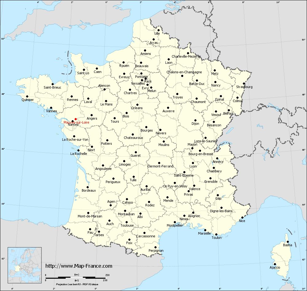
Here is the localization of Mauves-sur-Loire on the France map of departments in Lambert 93 coordinates. The city of Mauves-sur-Loire is shown on the map by a red point.
The city of Mauves-sur-Loire is located in the department of Loire-Atlantique of the french region Pays de la Loire.
The latitude of Mauves-sur-Loire is 47.298 degrees North.
The longitude of Mauves-sur-Loire is 1.394 degrees West.
Here the distance between Mauves-sur-Loire and the biggest cities of France:
Distances are calculated as the crow flies (orthodromic distance)
Distance between Mauves-sur-Loire and Paris : 327.38 kilometers
Distance between Mauves-sur-Loire and Marseille : 691.96 kilometers
Distance between Mauves-sur-Loire and Lyon : 505.68 kilometers
Distance between Mauves-sur-Loire and Toulouse : 466.76 kilometers
Distance between Mauves-sur-Loire and Nice : 782.67 kilometers
Distance between Mauves-sur-Loire and Nantes : 14.89 kilometers
Distance between Mauves-sur-Loire and Strasbourg : 695.4 kilometers
Distance between Mauves-sur-Loire and Montpellier : 579.89 kilometers
Distance between Mauves-sur-Loire and Bordeaux : 279.94 kilometers
Distance between Mauves-sur-Loire and Lille : 491.5 kilometers
Distance between Mauves-sur-Loire and Rennes : 92.5 kilometers
Distance between Mauves-sur-Loire and Reims : 456.32 kilometers
Clic here to see the map of Mauves-sur-Loire in full screen:
Mauves-sur-Loire on the map of french departments
|
This administrative map of Mauves-sur-Loire is reusable and modifiable by making a link to this page of the Map-France.com website or by using the given code :
|
Administrative base maps of Mauves-sur-Loire
|

See the administrative base map of Mauves-sur-Loire in full screen (1000 x 949)
|
Small administrative base map of Mauves-sur-Loire
|
This base map administrative of Mauves-sur-Loire is reusable and modifiable by making a link to this page of the Map-France.com website or by using the given code :
|
 French Version : http://www.cartesfrance.fr