Map of France

Reinhardsmunster photos


Find a town, a zip code,
a department, a region... in France
I like Map-France.com !


Reinhardsmunster pictures


Here are the photos of the town of Reinhardsmunster and nearby towns. Reinhardsmunster is located in the department of Bas-Rhin in the region of Alsace. You will find the satellite map of Reinhardsmunster under these photos.

To see photos of nearby towns of Reinhardsmunster, you can try the following links :
   - Hengwiller pictures : town located at 1.43 km
   - Birkenwald pictures : town located at 2.62 km
   - Dimbsthal pictures : town located at 2.94 km
   - Thal-Marmoutier pictures : town located at 3.85 km
   - Salenthal pictures : town located at 3.92 km
   - Haegen pictures : town located at 4.40 km
   - Allenwiller pictures : town located at 4.86 km
   - Wangenbourg-Engenthal pictures : town located at 4.92 km
   - Marmoutier pictures : town located at 4.96 km
   - Singrist pictures : town located at 5.19 km
   - Gottenhouse pictures : town located at 5.94 km
   - Dabo pictures : town located at 6.45 km

 - photos of the department prefecture of Bas-Rhin : photos of Strasbourg
 - pictures of others cities of Bas-Rhin : Bas-Rhin


To see Reinhardsmunster from the sky, here is the satellite map of the town of Reinhardsmunster : Reinhardsmunster map.

I like Reinhardsmunster !


Photos of the town of Reinhardsmunster

These photos taken near the town of Reinhardsmunster can be shown in full screen clicking on the thumbnails. Photos are copyrighted by their owners.

Setra S417 ÜL n°S269 de la CTBR (Striebig-Keolis) sur la ligne 235 à destination de Dorlisheim Le Trèfle, partant de Wasselone en mars 2024 - Photo of Reinhardsmunster
Setra S417 ÜL n°S269 de la CTBR (Striebig-Keolis) sur la ligne 235 à destination de Dorlisheim Le Trèfle, partant de Wasselone en mars 2024

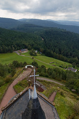
Rocher de Dabo - Photo of Reinhardsmunster
Rocher de Dabo

Rocher de Dabo - Photo of Reinhardsmunster
Rocher de Dabo

Plan incliné de Saint Louis-Arzviller - Photo of Reinhardsmunster
Plan incliné de Saint Louis-Arzviller

Plan incliné de Saint Louis-Arzviller - Photo of Reinhardsmunster
Plan incliné de Saint Louis-Arzviller

Rose garden at services - Photo of Reinhardsmunster
Rose garden at services

Old canal lock near Henridorff - Photo of Reinhardsmunster
Old canal lock near Henridorff

Canal de la Marne au Rhin in Lutzelbourg - Photo of Reinhardsmunster
Canal de la Marne au Rhin in Lutzelbourg

Former regional border along the canal - Photo of Reinhardsmunster
Former regional border along the canal

Canal de la Marne au Rhin in Lutzelbourg - Photo of Reinhardsmunster
Canal de la Marne au Rhin in Lutzelbourg

Zorn Valley - Photo of Reinhardsmunster
Zorn Valley

Lock on the canal in Lutzelbourg - Photo of Reinhardsmunster
Lock on the canal in Lutzelbourg

Zorn Valley - Photo of Reinhardsmunster
Zorn Valley

Priority to the slowest - Photo of Reinhardsmunster
Priority to the slowest


Reinhardsmunster from the sky


Old photos of the town of Reinhardsmunster

These photos taken near the town of Reinhardsmunster can be shown in full screen clicking on the thumbnails. Photos are copyrighted by their owners.


Other maps, hotels and towns in france


Find another town, zip code, department, region, ...


Quick links Reinhardsmunster :


Back to the menus Map of France :


Make a link to this page of Reinhardsmunster with the following code :


Map of France | Regions | Departments | Cities | Partners | Terms | Contact