|
The village of Saint-André is a small village located south of France. The town of Saint-André is located in the department of Tarn of the french region Midi-Pyrénées. The town of Saint-André is located in the township of Alban part of the district of Albi. The area code for Saint-André is 81240 (also known as code INSEE), and the Saint-André zip code is 81250.
Geography and map of Saint-André :
The altitude of the city hall of Saint-André is approximately 427 meters. The Saint-André surface is 7.27 km ². The latitude and longitude of Saint-André are 43.933 degrees North and 2.46 degrees East.
Nearby cities and towns of Saint-André are :
Trébas (81340) at 2.18 km, Curvalle (81250) at 3.93 km, Courris (81340) at 4.87 km, Assac (81340) at 4.91 km, Le Fraysse (81430) at 4.96 km, Cadix (81340) at 5.03 km, Alban (81250) at 5.06 km, La Bastide-Solages (12550) at 5.33 km.
(The distances to these nearby towns of Saint-André are calculated as the crow flies)
Population and housing of Saint-André :
The population of Saint-André was 107 in 1999, 102 in 2006 and 102 in 2007. The population density of Saint-André is 14.03 inhabitants per km². The number of housing of Saint-André was 105 in 2007. These homes of Saint-André consist of 46 main residences, 50 second or occasional homes and 9 vacant homes. |
|
|
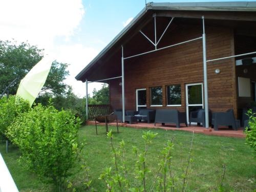
Hotel Saint-André
|
|
|
Book now ! Best Price Guaranteed, no booking fees, pay at the hotel with our partner Booking.com, leader in online hotel reservation.
Find all hotels of Saint-André : Hotel Saint-André
| |
|
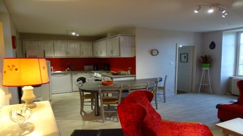
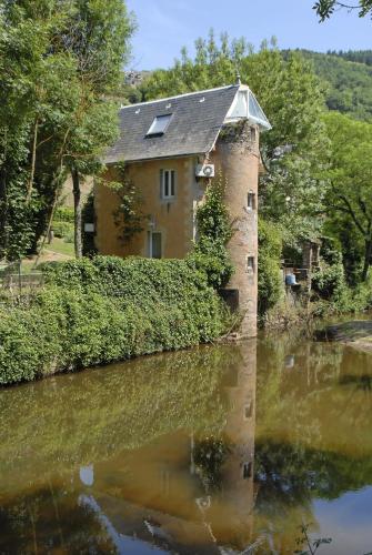
Guest accommodation : Gite Le Lucimond

Boasting accommodation with a terrace, Gite Le Lucimond is located in Saint-André. The property features river views and is 35 km from Albi. Offering direct access to a balcony...
Address : LIEU DIT GOS 81250 Saint-André
Distance Guest accommodation - Saint-André : 0.89 km
|
|
|
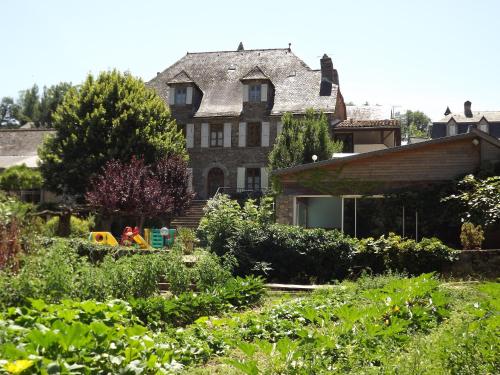
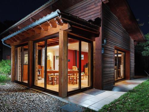
Hotel : Logis Hostellerie des Lauriers
Logis Hostellerie Des Lauriers sits in the Tarn Valley, 30 km from Albi. It offers en suite rooms with bath or shower and free Wi-Fi internet access. Le Restaurant serves regio...
Contact : Près d'Alban 81250 Alban
Distance Hotel - Saint-André : 1.31 km
|
|
|
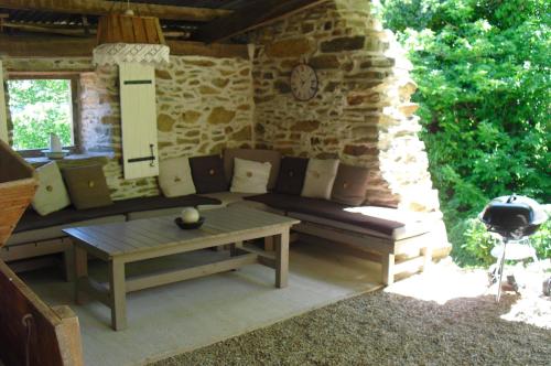
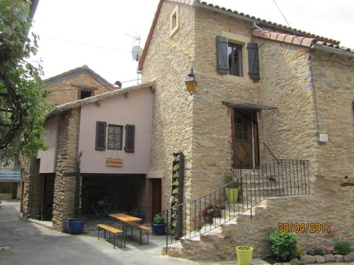
Guest accommodation : La Pelissarie
Offering a garden with views over a valley, La Pelissarie is a holiday home located in Midi-Pyrénées. It has a studio set in an ancient stone farm. At La Pelissarie, guests can...
Prices : from 50.00 €
Contact : La Pelissarie 81250 Curvalle
Distance Guest accommodation - Saint-André : 7.00 km
|
|
|
Hotel : Les Magnolias
Set in the Aveyron countryside, in the village Plaisance-sur-Rance, Les Magnolias is a historic and luxurious hotel. Guests can relax in one of its two outdoor terraces shaded b...
Contact : Rue Magnolias 12550 Plaisance
Distance Hotel - Saint-André : 7.13 km
|
|
|
Guest accommodation : Team Holiday - Camping Domaine Vallée du Tarn
Camping Domaine Vallée du Tarn is set 25 km east of Albi on a 17-hectare estate. It offers an outdoor swimming and paddling pool, evening entertainment and a snack bar. The cha...
Price : from 59.00 €
to 96.50 €
Address : Hameau des Vignes 81340 Saint-Cirgue
Distance Guest accommodation - Saint-André : 7.41 km
|
|
|
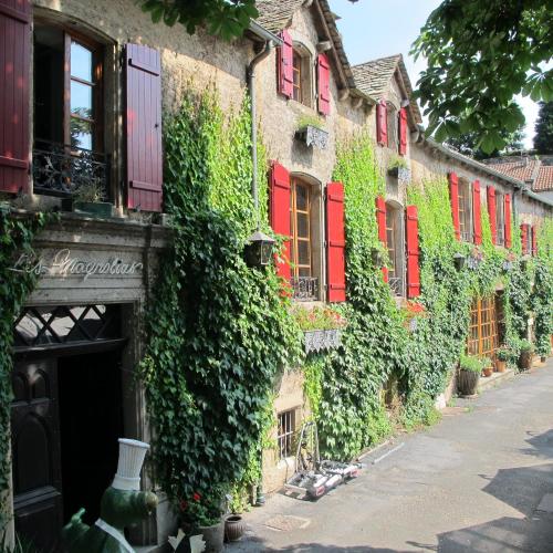
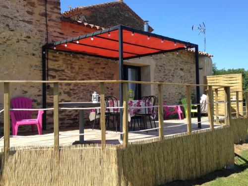
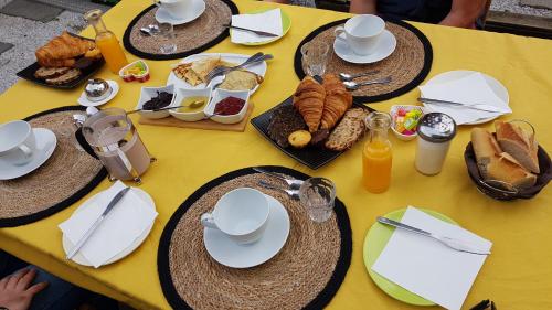
Bed and Breakfast : Chambres d'Hôtes Auberg'inn
Chambres d'Hôtes Auberg'inn features accommodation with barbecue facilities and free WiFi, and is situated in Ambialet. There is a fully equipped private bathroom with shower a...
Contact : la Condomine 81430 Ambialet
Distance Bed and Breakfast - Saint-André : 8.11 km
|
|
|
Guest accommodation : La Bouriote
Set in Villefranche-dʼAlbigeois, La Bouriote offers free bikes, free WiFi, a 24-hour front desk, and a concierge service. Housed in a building dating from 18th century, the holi...
Contact : Rue de la Bouriotte 81430 Villefranche-dʼAlbigeois
Distance Guest accommodation - Saint-André : 11.03 km
|
|
|
Guest accommodation : Maison d'Hôtes Hameau de Taur
Hameau de Taur is located in Villefranche-d’Albigeois in the countryside, 15 km from Albli. Free WiFi access is available. At Hameau de Taur you will also find a garden with a t...
Price : from 65.00 €
to 69.00 €
Contact : 1551 route de taur 81430 Villefranche-dʼAlbigeois
Distance Guest accommodation - Saint-André : 11.66 km
|
|
|
Hotel : HOTEL BEAUREGARD
Situated between Albi and Millau, 40 kilometres from the Millau Viaduct and Roquefort cheese caves, the HOTEL BEAUREGARD offers traditional hotel services and excellent cuisine....
Address : Place Du Fort 12380 Saint-Sernin-sur-Rance
Distance Hotel - Saint-André : 12.73 km
|
|
|
Guest accommodation : Maison De Vacances - Connac
Located in Réquista, Maison De Vacances - Connac features accommodation with a terrace and free WiFi. Guests staying at this holiday home have access to a fully equipped kitchen...
Contact : 12170 Réquista
Distance Guest accommodation - Saint-André : 14.76 km
|
|
Find another hotel near Saint-André : Saint-André hotels list
|
Map of Saint-André
|
|
Map of Saint-André :
At right you can find the localization of Saint-André on the map of France. Below, this is the satellite map of Saint-André. A road map, and maps templates of Saint-André are available here : "road map of Saint-André". This map show Saint-André seen by the satellite of Google Map. To see the streets of Saint-André or move on another zone, use the buttons "zoom" and "map" on top of this dynamic map.
Search on the map of Saint-André :
To search hotels, housings, tourist information office, administrations or other services, use the Google search integrated to the map on the following page : "map Saint-André".
Hotels of Saint-André are listed on the map with the following icons: 
The map of Saint-André is centred in the following coordinates :
|

|
|
|
|
Print the map of Saint-André

Print the map of Saint-André : map of Saint-André
|
Photos Saint-André
|
See all photos of Saint-André :
Other photos of Saint-André and nearby towns can be found here: photos Saint-André
|
|
Saint-André weather forecast
Find next hours and 7 days weather forecast for Saint-André here : weather Saint-André (with english metrics)
This is the last weather forecast for Saint-André collected by the nearest observation station of Alban.
Week Forecast:
The latest weather data for Saint-André were collected Monday, 14 April 2025 at 19:08 from the nearest observation station of Alban.
| Monday, April 14th |
17°C 9°C
72%
76%
|
Rain
Temperature Max: 17°C Temperature Min: 9°C
Precipitation Probability: 72% (Rain)
Percentage of sky occluded by clouds: 76%
Wind speed: 15 km/h North-West
Humidity: 76%° UV Index: 4
Sunrise: 07:08 Sunset: 20:33 |
|
| | Tuesday, April 15th |
13°C 7°C
93%
97%
|
Rain
Temperature Max: 13°C Temperature Min: 7°C
Precipitation Probability: 93% (Rain)
Percentage of sky occluded by clouds: 97%
Wind speed: 11 km/h East
Humidity: 85%° UV Index: 3
Sunrise: 07:06 Sunset: 20:34 |
|
| | Wednesday, April 16th |
12°C 6°C
75%
88%
|
Rain
Temperature Max: 12°C Temperature Min: 6°C
Precipitation Probability: 75% (Rain)
Percentage of sky occluded by clouds: 88%
Wind speed: 14 km/h South-East
Humidity: 74%° UV Index: 3
Sunrise: 07:05 Sunset: 20:35 |
|
| | Thursday, April 17th |
13°C 5°C
33%
79%
|
Drizzle
Temperature Max: 13°C Temperature Min: 5°C
Precipitation Probability: 33% (Rain)
Percentage of sky occluded by clouds: 79%
Wind speed: 22 km/h South-East
Humidity: 70%° UV Index: 4
Sunrise: 07:03 Sunset: 20:36 |
|
|
Attribution: 
|
|
Other maps, hotels and towns in france
Find another town, zip code, department, region, ...
Quick links Saint-André :
Make a link to this page of Saint-André with the following code :
|
|
|
 French Version : http://www.cartesfrance.fr/carte-france-ville/81240_Saint-Andre.html


