|
The village of Vriange is a small village located east of France. The town of Vriange is located in the department of Jura of the french region Franche-Comté. The town of Vriange is located in the township of Rochefort-sur-Nenon part of the district of Dole. The area code for Vriange is 39584 (also known as code INSEE), and the Vriange zip code is 39700.
Geography and map of Vriange :
The altitude of the city hall of Vriange is approximately 240 meters. The Vriange surface is 5.78 km ². The latitude and longitude of Vriange are 47.18 degrees North and 5.582 degrees East.
Nearby cities and towns of Vriange are :
Amange (39700) at 2.07 km, Malange (39700) at 2.59 km, Romange (39700) at 2.74 km, Lavangeot (39700) at 3.77 km, Serre-les-Moulières (39700) at 3.94 km, Offlanges (39290) at 3.96 km, Châtenois (39700) at 4.34 km, Lavans-lès-Dole (39700) at 4.41 km.
(The distances to these nearby towns of Vriange are calculated as the crow flies)
Population and housing of Vriange :
The population of Vriange was 137 in 1999, 144 in 2006 and 136 in 2007. The population density of Vriange is 23.53 inhabitants per km². The number of housing of Vriange was 80 in 2007. These homes of Vriange consist of 64 main residences, 12 second or occasional homes and 4 vacant homes. |
|
|
Hotel Vriange
|
|
|
Book now ! Best Price Guaranteed, no booking fees, pay at the hotel with our partner Booking.com, leader in online hotel reservation.
Find all hotels of Vriange : Hotel Vriange
| |
|
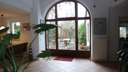
Apartment : Immergrün Apartment bei Dole
Offering free WiFi and garden views, Immergrün Apartment bei Dole is an accommodation set in Menotey. This property offers access to a terrace. Leading onto a patio, the apartm...
Address : 5, rue de l'Alambic 39290 Menotey
Distance Apartment - Vriange : 6.74 km
|
|
|
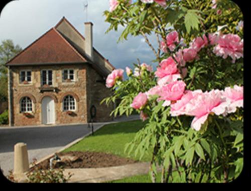
Bed and Breakfast : Le Lavoir
Le Lavoir is located in Peintre, 13 km from Dole and 25 km from Beaune and Besançon. With free WiFi, the property features a shared kitchen, a big garden and free private parkin...
Price : from 58.00 €
to 91.00 €
Contact : 9 rue du lavoir 39290 Peintre
Distance Bed and Breakfast - Vriange : 7.83 km
|
|
|
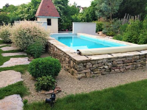
Bed and Breakfast : De Pierre et de Lumière
Featuring a swimming pool, a garden and a terrace and views of the river, De Pierre et de Lumière is set in Jouhe and provides accommodation with free WiFi. Boasting views of t...
Prices : from 75.00 €
to 85.00 €
Contact : 5, rue de la platiere 39100 Jouhe
Distance Bed and Breakfast - Vriange : 8.08 km
|
|
|
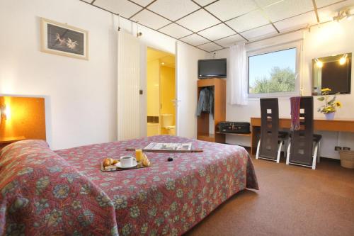
Hotel : Hotel The Originals Dole Éric (ex Inter-Hotel)
 
Located at the entrance of the city of Dole,Hotel The Originals Dole Éric (ex Inter-Hotel) welcomes you in a cosy atmosphere. The hotel boasts an outdoor swimming pool and offer...
Rate : from 66.00 €
to 73.00 €
Contact : Les Epenottes / 11 Rue Alexandre Vialatte 39100 Dole
Distance Hotel - Vriange : 9.82 km
|
|
|
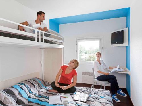
Hotel : hotelF1 Dole
Located in the centre of Dole, the F1 Dole hotel offers basic comfort accommodation and a buffet breakfast every morning. It is just a 5-minute drive from the A36 motorway. Dec...
Price : from 26.75 €
to 44.41 €
Address : 6 rue Alexandre Vialatte 39100 Dole
Distance Hotel - Vriange : 9.84 km
|
|
|
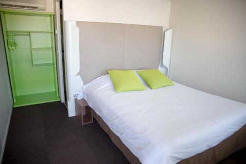
Hotel Campanile is 2 kilometres from the centre of Dole and the train station. It sits 5 kilometres from the Dole-Tavaux Airport and is directly accessible from the A36 motorway...
Prices : from 45.00 €
to 79.00 €
Contact : 12 Rue J.M. Jacquard, 39100 Dole
Distance Hotel - Vriange : 10.15 km
|
|
|
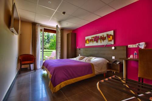
Hotel : Le Chalet du Mont Roland
Located in a natural setting, just 3 km from the centre of Sampans, this hotel offers mountain views. Guests can relax on the furnished terrace with a drink from the bar and Dol...
Rate : from 85.00 €
to 115.00 €
Contact : Lieu dit Le Mont Roland 39100 Dole
Distance Hotel - Vriange : 10.22 km
|
|
|
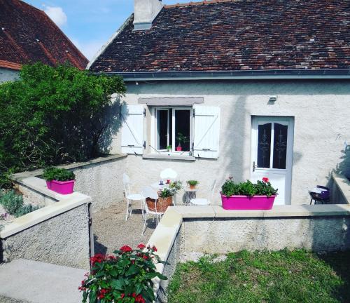
Guest accommodation : Le Four à Pains
 
Le Four à Pains in Dole provides accommodation with free WiFi, 1.7 km from Birthplace - Pasteur museum and 3 km from The museum of fine arts of Dole. This property offers access...
Price : from 58.50 €
to 96.00 €
Contact : 110 Rue des Commards 39100 Dole
Distance Guest accommodation - Vriange : 10.58 km
|
|
|
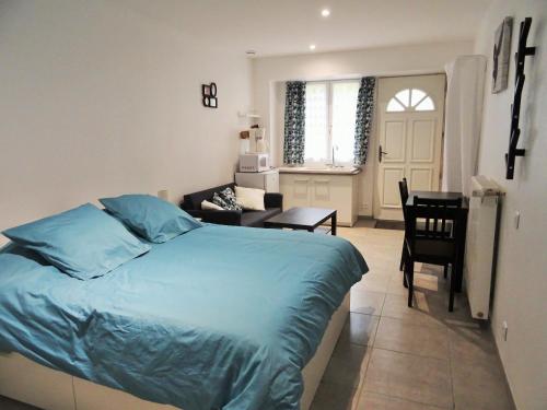
Apartment : Studio les jardins Gourmands
Studio les jardins Gourmands is set in Pesmes. The accommodation is 44 km from Besançon. The apartment consists of 1 separate bedroom, 1 bathroom, and a seating area. A flat-sc...
Prices : from 50.00 €
Address : Route de Dole 70140 Pesmes
Distance Apartment - Vriange : 10.88 km
|
|
|
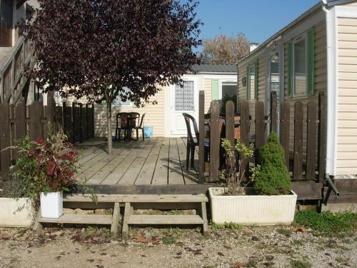
Guest accommodation : Les Jardins Gourmands
Featuring accommodation with a terrace, Les Jardins Gourmands is set in Pesmes. This holiday home also features a restaurant. The holiday home consists of 2 separate bedrooms, ...
Rate : from 30.00 €
to 70.00 €
Contact : Route de Dole 70140 Pesmes
Distance Guest accommodation - Vriange : 10.90 km
|
|
Find another hotel near Vriange : Vriange hotels list
|
Map of Vriange
|
|
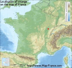
Map of Vriange :
At right you can find the localization of Vriange on the map of France. Below, this is the satellite map of Vriange. A road map, and maps templates of Vriange are available here : "road map of Vriange". This map show Vriange seen by the satellite of Google Map. To see the streets of Vriange or move on another zone, use the buttons "zoom" and "map" on top of this dynamic map.
Search on the map of Vriange :
To search hotels, housings, tourist information office, administrations or other services, use the Google search integrated to the map on the following page : "map Vriange".
Hotels of Vriange are listed on the map with the following icons: 
The map of Vriange is centred in the following coordinates :
|
|
|
|
|
Print the map of Vriange

Print the map of Vriange : map of Vriange
|
Photos Vriange
|
See all photos of Vriange :
Other photos of Vriange and nearby towns can be found here: photos Vriange
|
|
Vriange weather forecast
Find next hours and 7 days weather forecast for Vriange here : weather Vriange (with english metrics)
This is the last weather forecast for Vriange collected by the nearest observation station of Rochefort-sur-Nenon.
Week Forecast:
The latest weather data for Vriange were collected Monday, 14 April 2025 at 19:05 from the nearest observation station of Rochefort-sur-Nenon.
| Monday, April 14th |
20°C 11°C
70%
71%
|
Rain
Temperature Max: 20°C Temperature Min: 11°C
Precipitation Probability: 70% (Rain)
Percentage of sky occluded by clouds: 71%
Wind speed: 4 km/h North
Humidity: 69%° UV Index: 4
Sunrise: 06:51 Sunset: 20:25 |
|
| | Tuesday, April 15th |
18°C 11°C
92%
90%
|
Rain
Temperature Max: 18°C Temperature Min: 11°C
Precipitation Probability: 92% (Rain)
Percentage of sky occluded by clouds: 90%
Wind speed: 14 km/h North-East
Humidity: 77%° UV Index: 4
Sunrise: 06:49 Sunset: 20:27 |
|
| | Wednesday, April 16th |
11°C 7°C
94%
99%
|
Rain
Temperature Max: 11°C Temperature Min: 7°C
Precipitation Probability: 94% (Rain)
Percentage of sky occluded by clouds: 99%
Wind speed: 9 km/h South
Humidity: 80%° UV Index: 3
Sunrise: 06:47 Sunset: 20:28 |
|
| | Thursday, April 17th |
11°C 6°C
83%
92%
|
Rain
Temperature Max: 11°C Temperature Min: 6°C
Precipitation Probability: 83% (Rain)
Percentage of sky occluded by clouds: 92%
Wind speed: 12 km/h South
Humidity: 78%° UV Index: 3
Sunrise: 06:46 Sunset: 20:29 |
|
|
Attribution: 
|
|
Other maps, hotels and towns in france
Find another town, zip code, department, region, ...
Quick links Vriange :
Make a link to this page of Vriange with the following code :
|
|
|

 French Version : http://www.cartesfrance.fr/carte-france-ville/39584_Vriange.html


