|
|
|
|
|
|
Region of Corse
|
|
Region Corse
|
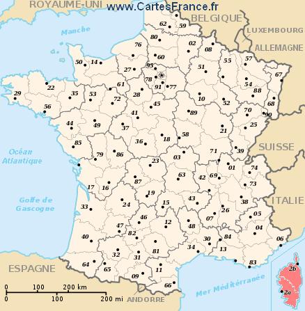
The region is the first level of administrative divisions on the France map.
The region of Corse has the number 94 and is divided into 2 departments, 5 districts, 52 townships and 360 municipalities. Below you will find the localization of Corse on the map of France, and the satellite map of Corse.
|
|
Inhabitants of Corse were 260 196 in the 1999 census and 294 118 in the 2006 census. Area of region of Corse is 8 679,79 km ². Population density of Corse is 33,89 inhabitants per km².
Biggest cities of region of Corse, in number of inhabitants, are (2007 census):
Ajaccio (2A), Bastia (2B), Porto-Vecchio (2A), Borgo (2B), Corte (2B), Biguglia (2B), Calvi (2B), Furiani (2B), Lucciana (2B), Ghisonaccia (2B), Propriano (2A), Bastelicaccia (2A), Prunelli-di-Fiumorbo (2B), Ville-di-Pietrabugno (2B), Sartène (2A), Alata (2A), Bonifacio (2A), Penta-di-Casinca (2B), L'Île-Rousse (2B), San-Martino-di-Lota (2B), Afa (2A), Grosseto-Prugna (2A), Vescovato (2B).
You will find the towns list of Corse in the bottom on this page. You can consult the map of France, pictures, hotels, and all data of every town and village in the region of Corse clicking on these towns links.
|
|
|
I like the region of
Corse !
|
|
|
|
|
|
|
|
|
Statistics of region of Corse |
| Population 1999 |
260 196 inhabitants |
|
| Population 2006 |
294 118 inhabitants |
|
| Area |
8 679.79 km ² |
|
| Population density |
33.89 inhabs/km²
|

|
| Variation of density |
+1.77 % |

|
| |
|
|
Administration of region of Corse |
| Number |
94 |
|
| Prefecture |
Ajaccio |
|
| Subprefectures |
Ajaccio
Bastia |

|
| Departments |
Corse-du-Sud (2A)
Haute-Corse (2B) |

|
| |
|
|
Subdivisions of the region of Corse |
| Departments |
2 |
|
| Districts |
5 |
|
| Townships |
52 |
|
| Municipalities |
360 |
|
| |
|
|
|
Hotel Corse
|
Book now ! Best Price Guaranteed, no booking fees, pay at the hotel with our partner Booking.com, leader in online hotel reservation.
| |
|
|
|
Hotel Corse-du-Sud
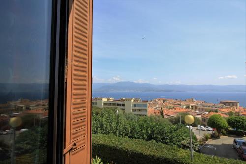
Appartement Ajaccio Vue mer
Appartement Ajaccio Vue mer is situated in Ajaccio, 1.7 km from Port des Cannes, in an area where snorkelling can be enjoyed. This apartment is 12 km from Sanguinaires Islands.
The apart...
Price : from 0.00 € to 0.00 €
Contact : 23 Avenue Imperatrice Eugenie 20000 Ajaccio
|
|
|
|
|
Hotel Haute-Corse
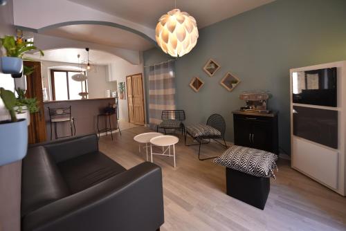
Hôtel du Palais Bastia Centre

In the heart of Bastia just a 5-minute walk from the port, Hôtel du Palais is a family-run hotel with 24-hour front desk and seating area with touristic brochures and newspapers. Free Wi...
Rate : from 44.10 € to 117.00 €
Contact : 2 Boulevard Paoli 20200 Bastia
|
|
|
Map of Corse
MAP OF THE REGION CORSE
|
Where is located the Corse region ?
The localisation of Corse is in red on the map of french regions.
What are the statistics and key data of Corse ?
The region of Corse has the number 94. It is composed of 2 departments, 5 districts ("arrondissements"), 52 townships ("cantons") and 360 towns ("communes").
The 2 departments of the region of Corse are:
Corse-du-Sud (2A), Haute-Corse (2B)
Inhabitants of Corse were 260 196 in 1999 and 294 118 in 2006.
The area of the region Corse is 8 679,79 km ². The population density of the region Corse is 33,89 inhabitants per km².
What are the largest cities of the region of Corse ?
The largest cities of the region of Corse (compared to the number of inhabitants in 2007) are :
Ajaccio (2A), Bastia (2B), Porto-Vecchio (2A), Borgo (2B), Corte (2B), Biguglia (2B), Calvi (2B), Furiani (2B), Lucciana (2B), Ghisonaccia (2B), Propriano (2A), Bastelicaccia (2A), Prunelli-di-Fiumorbo (2B), Ville-di-Pietrabugno (2B), Sartène (2A), Alata (2A), Bonifacio (2A), Penta-di-Casinca (2B), L'Île-Rousse (2B), San-Martino-di-Lota (2B), Afa (2A), Grosseto-Prugna (2A), Vescovato (2B).
Interactive map of the Corse region
You can zoom the satellite map of Corse to see a village or a city, for example Ajaccio.
Search a town of region Corse
|
|
|
|
|
|
Records of the Corse region: Did you know ?
The town with the longest name of the region of Corse is: Santa-Reparata-di-Balagna
The town with the shortest name of the region of Corse is: Afa
The municipality with the highest altitude of the department region of Corse is: Lozzi with 1020 m
The municipality with the lowest altitude of the region of Corse is: Saint-Florent with 3 m
The municipality with the largest area of the region of Corse is: Sartène with 200.40 km ²
The municipality with the smallest area of the region of Corse is: Piazzali with 0.78 km ²
|
Towns list of the Corse region
Follow the links of towns and cities of the Corse region and see photos, maps, and informations for these towns.
|
List of french departments
|
Other regions, departments, maps, hotels and towns in france
Find another town, zip code, department, region, ...
Back to the menus Map of France :
Make a link to this pageZuani with the following code :
|
Find a town in France by clicking on the following interactives maps :
|
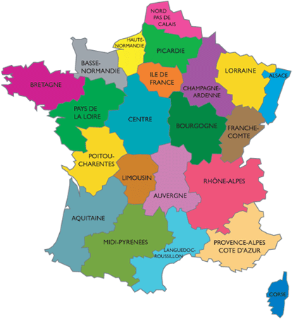
Map of french regions
|
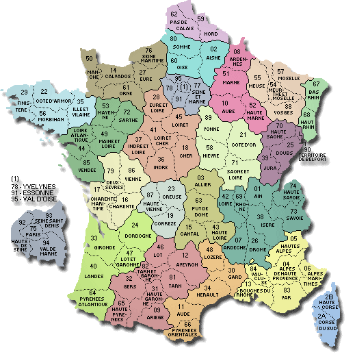
Map of french departments
|
|
Map of France | Regions | Departments | Cities | Partners | Terms | Contact
 French version : Corse | Carte de France French version : Corse | Carte de France
|

 French Version : Corse
 French version : Corse | Carte de France


